

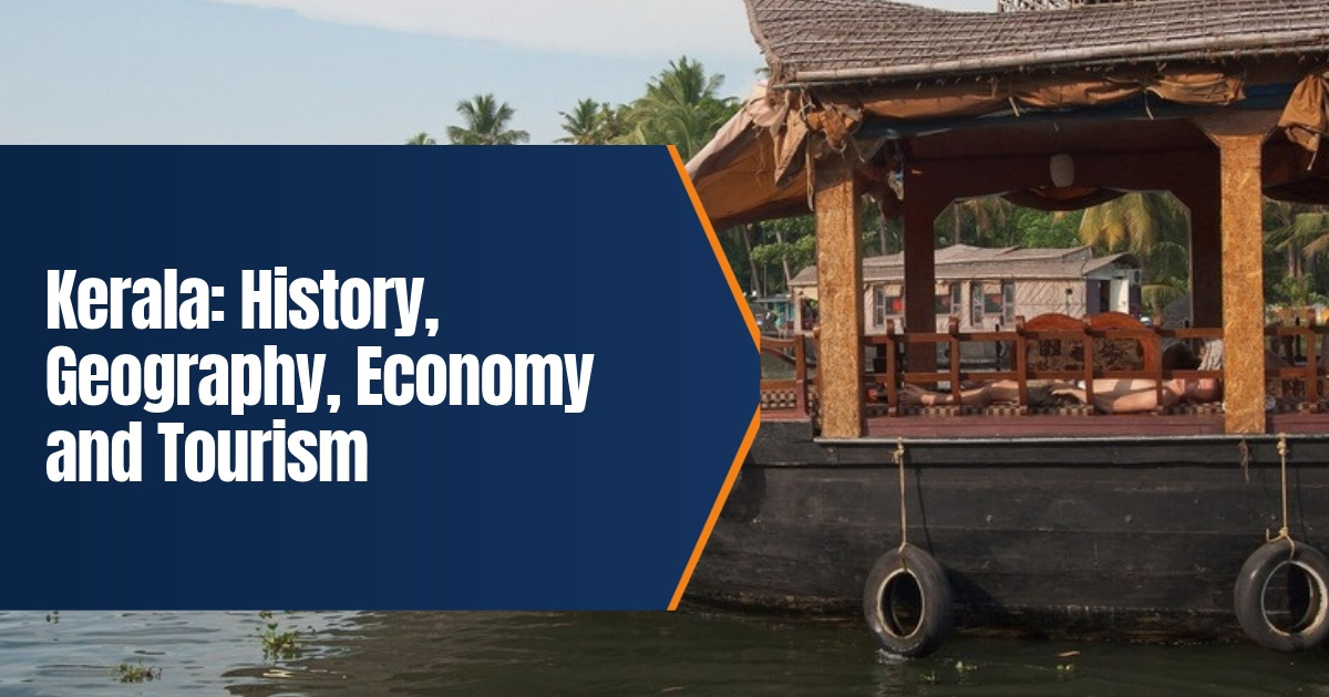
Kerala: History, Geography, Economy and Tourism
Kerala is a narrow state on India’s southwest coast, squeezed between the Western Ghats and the Arabian Sea. It is known for its backwaters, spices, high literacy and strong links with the Gulf. This guide to Kerala’s history, geography, economy and tourism brings the key facts together in one place and has been updated in October 2026 with the latest tourism and development figures.
Table of Contents
Quick Facts
| Item | Detail |
|---|---|
| Formed | 1 November 1956 |
| Capital | Thiruvananthapuram |
| Area | 38,863 sq km |
| Districts | 14 |
| Main language | Malayalam |
| Coastline | About 595 km |
| Literacy | 94% (2011 census), 96.2% (2018 survey) |
History of Kerala
Ancient Trade
Kerala has traded spices with the wider world for thousands of years. Records suggest pepper and other spices left this coast as early as 3000 BCE, which is why the region is often called the spice garden of India. Ancient ports such as Muziris drew traders from Mesopotamia, Egypt, Greece and Rome. Tamil Sangam poems describe Roman ships arriving at Muziris with gold to exchange for pepper.
The Cheras and Early Kingdoms
The Cheras were among the earliest known rulers of the region. Kerala also appears in the edicts of the Mauryan emperor Ashoka in the third century BCE, which mention a land called Keralaputra. Over the centuries, the region was divided among several kingdoms, including Venad, Kochi and the Zamorins of Kozhikode.
Faiths Arrive by Sea
Trade brought new faiths early. Christianity has deep roots on this coast. The Cheraman Juma Masjid at Kodungallur is traditionally dated to 629 CE and is often described as one of the oldest mosques in India. Kochi’s Paradesi Synagogue, built in 1568, is one of the oldest active synagogues in the Commonwealth.
European Powers
In 1498 the Portuguese navigator Vasco da Gama landed at Kappad near Kozhikode, opening a direct sea route from Europe. The Portuguese, Dutch and later the British competed for the spice trade. In the eighteenth century, Marthanda Varma made Travancore the strongest kingdom in the south, while Malabar came under direct British rule.
Formation of the Modern State
After independence, Travancore and Kochi merged in 1949. On 1 November 1956, under the States Reorganisation Act, the Malayalam speaking regions were brought together as Kerala, with Malabar added and some southern areas passed to Madras State. Kerala Piravi, the state’s birthday, is still celebrated every 1 November.
Geography of Kerala
Kerala covers 38,863 square kilometres, a little over one percent of India’s land area. It borders Karnataka to the north and northeast and Tamil Nadu to the east, with the Lakshadweep islands out to the west. The land falls into three broad belts: the high Western Ghats in the east, the midland hills in the centre, and the coastal plain along the sea.
- Coast. About 595 kilometres of coastline, with long beaches and fishing harbours.
- Rivers. Forty four rivers, mostly short and fast. The Periyar, at 244 kilometres, is the longest.
- Backwaters. A network of lagoons, lakes and canals runs parallel to the coast. Vembanad is the longest lake.
- Hills. The Western Ghats hold tea and spice estates, forests and wildlife reserves.
Kerala is usually the first state in India to receive the southwest monsoon, around the start of June. Heavy rain makes it green for much of the year, but also exposes it to floods and landslides, as the deadly floods of 2018 and the Wayanad landslides of 2024 showed.
Districts of Kerala
Kerala has had 14 districts since 1984. From south to north they are Thiruvananthapuram, Kollam, Pathanamthitta, Alappuzha, Kottayam, Idukki, Ernakulam, Thrissur, Palakkad, Malappuram, Kozhikode, Wayanad, Kannur and Kasaragod. Idukki is the largest by area and is home to much of the state’s hill country, while Malappuram has the largest population. Ernakulam, which includes Kochi, is the busiest commercial district. Wayanad, high in the Western Ghats, is known for coffee, spices and forests.
Environment and Climate Challenges
Kerala’s steep hills, heavy rain and dense population make it vulnerable to extreme weather. The 2018 floods were the worst in about a century, and landslides in Wayanad in 2024 caused heavy loss of life. Coastal erosion affects fishing villages, and the backwaters face pressure from pollution and land reclamation. The state now places more weight on early warnings, mapping of landslide prone slopes and careful planning of building in the hills.
People and Society
Kerala’s 2011 census population was about 3.34 crore. The state stands out on social measures. Literacy was 94 percent in 2011 and 96.2 percent in a 2018 national survey, the highest in India. It also had the highest sex ratio in the 2011 census, with 1,084 women for every 1,000 men, and it ranks at or near the top of Indian states for life expectancy and human development. Malayalam is the main language, with English also used officially.
Economy of Kerala
Remittances
Large numbers of Keralites work abroad, especially in the Gulf states, a pattern that grew from the 1970s. The money they send home is a major part of the economy, worth more than a fifth of the state’s gross domestic product by some estimates.
Agriculture and Plantations
Coconut, rubber, tea, coffee, cashew and spices such as pepper and cardamom are important crops. Fishing supports many coastal communities.
Services, Technology and Ports
Services make up the largest share of the economy. Technology parks in Thiruvananthapuram and Kochi host software firms. The Vizhinjam International Seaport near Thiruvananthapuram, a deep water container port, was dedicated to the nation on 2 May 2025 and is expected to bring shipping and logistics jobs.
Poverty and Welfare
On 1 November 2025, Kerala declared itself free of extreme poverty after a state programme identified and supported the poorest households. Its welfare model, with strong public health and education, is widely studied.
Tourism in Kerala
Tourism is one of Kerala’s best known industries, promoted under the slogan God’s Own Country. In 2025 the state recorded about 2.58 crore tourist arrivals, its highest ever, including 2,50,58,366 domestic and 8,21,999 foreign visitors.
- Backwaters. Houseboat trips around Alappuzha and Kumarakom are the most famous experience.
- Hill stations. Munnar, Wayanad and Thekkady offer tea gardens, spice farms and forest reserves.
- Beaches. Kovalam, Varkala and Marari are popular.
- Heritage. Fort Kochi, Mattancherry and Muziris sites show the state’s trading past.
- Ayurveda. Traditional treatments draw many visitors.
Getting Around Kerala
Kerala is compact, so most places are a few hours apart by road or rail. A main railway line runs the length of the coast, linking Thiruvananthapuram, Kollam, Kochi, Thrissur, Kozhikode and Kannur. Kochi has a metro rail system and a water metro that uses electric boats to link the city’s islands. State run buses reach almost every town, and ferries still serve many backwater villages. For hill stations such as Munnar and Wayanad, road travel is the only option, and mountain roads can be slow during the monsoon.
Culture and Festivals
Onam, the harvest festival, is the biggest celebration, marked by flower carpets, feasts and boat races. Kerala’s arts include Kathakali, Mohiniyattam and Theyyam. The snake boat races, such as the Aranmula boat race, draw large crowds. Kerala’s cuisine relies on rice, coconut and seafood, with the vegetarian sadya feast served on a banana leaf.
Read more in our posts on Munnar hill station, Mohiniyattam, the Aranmula boat festival and Kerala Natanam.
The best time for most visitors is from October to March, after the main monsoon has passed.
Kerala has three major airports at Thiruvananthapuram, Kochi and Kozhikode, plus Kannur in the north.
Kochi airport is known as the first in the world to run fully on solar power.
Periyar Tiger Reserve near Thekkady is one of the best known wildlife areas in south India.
Traditional Chinese fishing nets at Fort Kochi date back to trade links from centuries ago.
Kerala’s houseboats, called kettuvallam, were once used to carry rice and spices along the backwaters.
The Western Ghats, which form Kerala’s eastern edge, are a UNESCO World Heritage Site.
Many visitors combine a backwater stay with a hill station and a beach in one week long trip.
Kerala’s Theyyam season in the north runs mostly from November to May, when shrines hold night long ritual performances.
Spice markets in Kochi’s Mattancherry area still trade pepper, cardamom and ginger much as they did in earlier centuries.
Responsible tourism projects in villages such as Kumarakom let visitors spend money directly with local farmers and craftspeople.
What We Changed From the Old Post
We corrected the state’s name, which the old post spelled as Kerela, and removed the dash from the title. We replaced older tourism figures with 2025 arrivals and added sourced points on remittances, the Vizhinjam port, the 2025 extreme poverty milestone, literacy and sex ratio. We also added a quick facts table, a clearer history timeline and a short note on floods and landslides.
Frequently Asked Questions
When was Kerala formed?
Kerala was formed on 1 November 1956 under the States Reorganisation Act.
What is the capital of Kerala?
Thiruvananthapuram is the capital. Kochi is the main commercial centre.
Why is Kerala called God’s Own Country?
It is a tourism slogan used since the late 1980s to promote the state’s natural beauty.
How many tourists visited Kerala in 2025?
About 2.58 crore, including roughly 8.2 lakh foreign tourists, a record for the state.